
(Banner photo courtesy of LTJG Alejandro J. Amezcua, NOAA/OMAO)
In the aftermath of a hurricane like Hurricane Ian, assessment of the damage and mapping is essential. Thankfully, NOAA: National Oceanic & Atmospheric Administration and the NOAA Commissioned Officer Corps began quickly after the storm to map the affected areas of Southwest Florida utilizing a Beechcraft King Air 350CER (NOAA68).
Numerous organizations including FEMA, state, and local emergency management are able to use the imagery the King Air maps to make real-time decisions concerning where resources should be dispatched.
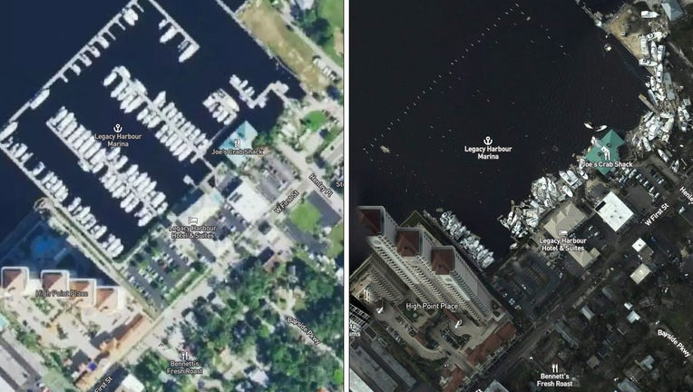
Legacy Harbour Marina, Downtown Fort Myers, before (left) and after (right) Hurricane Ian. (NOAA)
Those first flights by NOAA covered a 50-mile area from the Cayo Costa (where landfall was made) down to Sanibel and then up the Caloosahatchee River to Fort Myers. The high resolution cameras captured images of many areas completely inundated with sand and water. Hurricane Ian was recorded to be Category 4 when it hit (150-mph winds accompanied with a 12-foot storm surge).
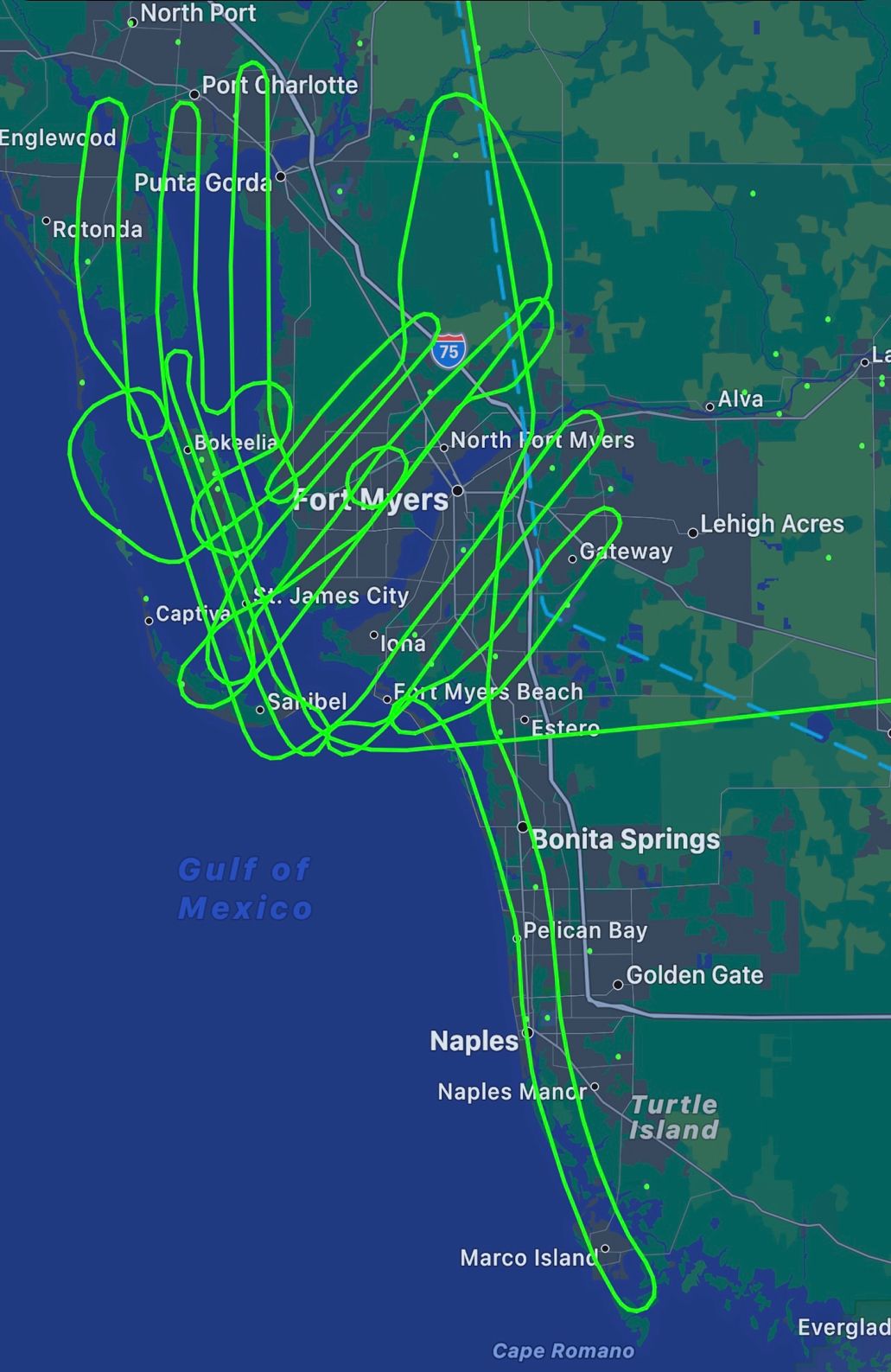
One of the imagery capturing flight paths of NOAA68 (NOAA)
According to a recent write up by Textron Aviation, one of the company's employees, Doug Scott, manager of Government Relations and Special Mission Communications, had recently moved to Sanibel, Florida. He evacuated to Fort Lauderdale and didn't know for several days what had happened to his home.

Bridge destruction, Sanibel Island, Florida (LTJG Alejandro J. Amezcua, NOAA/OMAO)
"So after hours of silence and assuming our home was completely destroyed, I saw that NOAA posted high definition imagery from four hours of circuits,” Doug said. “They were flying a King Air 350 over Sanibel, Cape Coral, and Fort Myers Beach – all the areas that were most negatively impacted by the effects of Ian.”
Doug was able to share the imagery NOAA provided so friends and family would have a better understanding of what the damage was. The value and importance of Special Missions King Air truly hit home for him:
“It’s just critically important. This catastrophe is so widespread. If it was just my neighbor and me, that’s one thing. But I think this is probably impacting hundreds of thousands of households here in southwest Florida, from Tampa down to the south of Marco Island on the southwest coast.”

Extensive flooding. (LTJG Alejandro J. Amezcua, NOAA/OMAO)
NOAA has continued to update its website with a full list of flights, tutorial, and all available imagery for free.
The official government website to apply for aid for those affected by Hurricane Ian is www.disasterassistance.gov.