
Let’s be honest, as King Air pilots, when it comes to weather, we might glance at the weather channel walking out of the hotel, take a quick look at radar images and sometimes go as far as a certified weather briefing prior to a flight. “We will be above it” or “that won’t affect our flight” are common phrases all of us have used. To our defense, these phrases typically mean we have confidence in our aircraft to outperform the weather. Now, don’t get me wrong, the King Air is a incredible machine and with the proper training and experience, her crew is just as efficient. However, if you find yourself in a different region of the world, the weather may also be very different and worth digging into a little further. Weather is very real and affects us as pilots every time we prepare for a flight. Not just during that flight however but watching the trends throughout the day so we can became mini weather guessers.
Before a recent flight, I had found myself looking quickly at weather and making that “go” decision and not visualizing the entire synopsis. The “how” and “why” of weather changes, if you will. I started reading Mr. Robert N. Buck’s book Weather Flying, the fourth edition, and have challenged myself to better understand the weather that affects me as a pilot. This book is the practical side of aviation weather from the mind of Robert Buck who spent 4 years of his aviation career specifically flying into weather for research. It really describes to readers how to combine the preflight weather briefing with actual conditions and prepare for changes. I highly recommend every pilot read this book.
The Aviation Weather curriculum we remember in our ground school books are great foundations to understanding how it affects us as pilots however, we should use this knowledge to dig deeper and better understand what we see from the front seat of the aircraft. Terminal Aerodrome Forecasts or TAF’s, METAR, Prog Charts, Airmets/Sigmets and many others are great ways to determine what is happening and what may happen during our flight. We can also get an idea with local weather on the news or our morning newspaper and even that “www dot” thing everyone is addicted to (including myself). This all sounds simple enough and those of us who fly now or are learning to fly, use this information to make that go/no-go decision for every flight.
After we receive all available information concerning weather for our cross-country flight, visualize it and determine what we might see. Do not settle with just looking at both hourly reports (METAR), which say the winds are calm. I challenge you to evaluate it further and give yourself a proper weather definition. Even if it is VFR at our departure and destination airport with calm winds aloft in the middle, eventually that perfect weather will move on and something will replace it. The goal is to attempt to determine if it will affect our flight and how fast things are changing.
Winds
What direction are they coming from? Are they bringing in warm moist air or cool dry air? Winds can help you determine which side of the front or pressure system you may be flying on. Also, performance for the aircraft being flown may be different when climbing or descending through a high or low pressure. Consider those wind flow characteristics clockwise, outward and down in a high, and counterclockwise, inward and up in a low. A climb to altitude through a low-pressure system may be quicker than a climb through higher-pressure. Although if moisture is presented to a low, the climb may be good but the weather very interesting!
Temperature/Dew point
Has a front just passed or is it about to? What change has caused a rise or drop in temp? Different locations along either a warm or cold front will bring different weather scenarios that we should be aware of. Remember when the temp and dew point get close together we have the possibility of visible moisture. So, be aware of temperature changes and the raising of the dew point through moisture and humidity.
Terrain
Ask an experienced pilot at your local airport about terrain and weather trends and be ready to take notes. These tips are a valuable piece of the pie when figuring out this weather stuff. Terrain has a huge impact on what the weather does for us. Land and sea breeze along a coastline or a large lake provide humidity and its own small weather system of highs and lows. The ascending or descending air along the Rockies can cause fog, cloud cover or even thunderstorms throughout the day.
Clouds
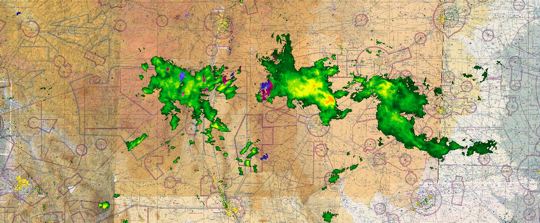
Why did they form? Many times clouds are not a major concern on our flights. They are above or below us and we really do not worry about them. Take the time and visualize why they formed. When temperature is cooled to its dew point and cannot contain the moisture any longer (100% humidity), visible moisture or clouds appear. Also, determine the type of cloud Stratus or Cumulus; these can be excellent clue to ride conditions along the way.
When gathering information, also take a look at Fronts, High and Low pressure systems, the jet stream, and the time of day and season we are in. All of these combined create the weather that we experience every day. This practical knowledge will help us better visualize weather as a whole and provide a confident evaluation of what we may experience on our flight(s).
Enjoy the ride,
Travis A.
About the Author
 Travis is a corporate pilot flying a Beechcraft King Air 200GT in the Chicago area. In addition, he is an active Flight Instructor focusing on primary and advanced students, and also works with a local Simulator School providing King Air initial and recurrent training in insurance approved flight training devices.