
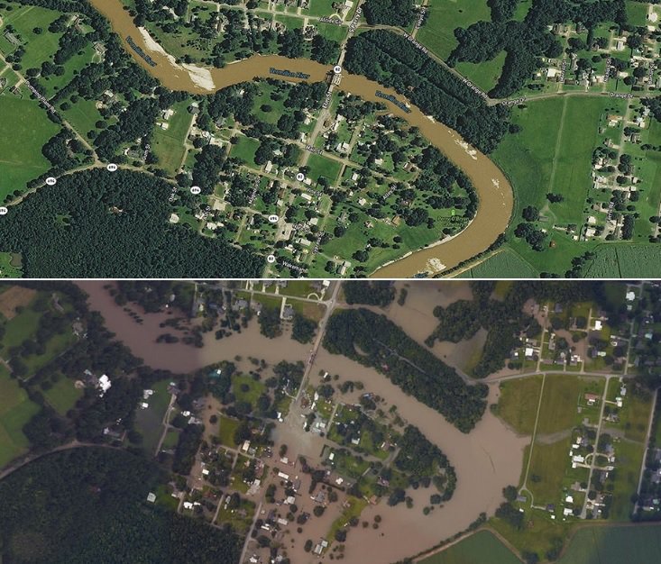
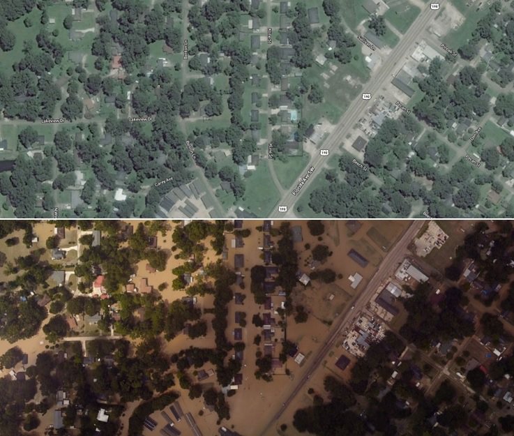
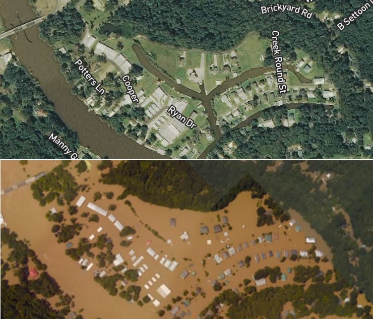
The National Oceanic and Atmospheric Administration (NOAA) conducted the National Geodetic Survey (NGS) this month to collect damage assessment imagery in the aftermath of the severe storms that caused massive flooding in Louisiana. The imagery was collected in specific areas identified by FEMA and the National Weather Service including Abbeville, Port Vincent and Denham Springs, Louisiana. A team of NOAA aviators captured the images using specialized remote-sensing cameras aboard NOAA’s King Air aircraft (350CER) flying above the area at an altitude between 2000-3000 feet.
NOAA’s aerial imagery aids safe navigation and captures damage to coastal areas caused by a storm. Aerial imagery is a crucial tool to determine the extent of the damage inflicted by flooding, and to compare baseline coastal areas to assess the damage to major ports and waterways, coastlines, critical infrastructure, and coastal communities. This imagery provides a cost-effective way to better understand the damage sustained to both property and the environment.
The NOAA King Air page notes their craft is “equipped with the latest aircraft technology, this King Air Special Mission aircraft’s main feature is the two large, downward-facing sensor ports that can support a wide variety of remote sensing systems, including digital cameras, multispectral and hyperspectral sensors, and topographic and bathymetric LIDAR systems. Other aircraft features include a cargo door, bubble windows, two window blanks, and additional mission power.”
NOAA’s aerial imagery aids safe navigation and captures damage to coastal areas caused by a storm. Aerial imagery is a crucial tool to determine the extent of the damage inflicted by flooding, and to compare baseline coastal areas to assess the damage to major ports and waterways, coastlines, critical infrastructure, and coastal communities. This imagery provides a cost-effective way to better understand the damage sustained to both property and the environment.