
Shortly after Hurricane Irma, the National Oceanic and Atmospheric Administration sent out their team of aviators to capture aerial imagery of locations affected by Hurricane Irma. The images will be used to help determine the extent of Irma’s damage.
NOAA’s Office of Marine and Aviation Operations and NOAA’s Geodetic Survey team use specialized cameras aboard a King Air and Twin Otter flying between 1,640 and 4,921 feet. The completed imagery is placed online for free public access.
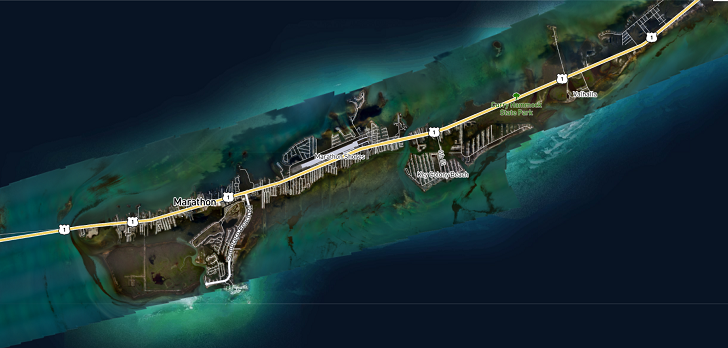
“By comparing the aerial — not satellite — imagery collected with baseline coastal datasets, response agencies can assess any damage to major ports and waterways, coastlines, critical infrastructure and coastal communities. This can help maintain or restore safe navigation and prioritize areas in need. In addition, imagery is used for ongoing research efforts to test and develop new airborne digital imaging standards,” NOAA noted.
According to NOAA, the agency uses a King Air 350CER.
“Equipped with the latest aircraft technology, this King Air Special Mission aircraft’s main feature is the two large, downward-facing sensor ports that can support a wide variety of remote sensing systems, including digital cameras, multispectral and hyperspectral sensors, and topographic and bathymetric LIDAR systems. Other aircraft features include a cargo door, bubble windows, two window blanks, and additional mission power,” says NOAA.
In a normal aircraft configuration the craft has seating for two pilots, a sensor operator, and 1-2 additional crew members.
(Source: NOAA)